Geographic InfoSystems, Remote Earth Sensing via Satellite and Drones, Map-Making, etc. Methods, tools and technologies you can use for all things GeoSpatial.
Welcome! So why are we here? Most common reasons include:
I’ve got a geospatial itch i am keen to scratch, but am stuck on some problem i can’t solve, and am reaching out for help with a particular question;
I’ve got knowledge or insight into some aspect of geospatial data science and/or tech that i think might be of help to someone in this group, which i’m happy to share;
I am more-or-less clueless about this whole problem-space, but i’ve heard enough buzz about it to make me curious to learn something more.
If you find yourself resonating with one or more of the above statements (/me: all of them, depending on the day!), then you have come to the right place. If you’d care to share a word or few about the background and/or motivations that drives or calls you here now, please do!
The core of the meet was focused on how we use WebODM Lightning to generate geospatial content, including orthophotos and 3D visualizations of the areas we are working on. For those unfamiliar with these tools, WebODM is an open-source software for processing drone imagery into geospatial data (more details here), and WebODM Lightning is a cloud-based version that simplifies processing and storage (more details here).
During the discussion, some general aspects were covered, but one key takeaway was the potential to integrate these outputs with QGIS. While the video may not have fully conveyed the possibilities of using these assets in platforms like QGIS, I came across some useful resources on combining WebODM outputs (such as contours) with QGIS for further analysis. Working with contours at WebODM and upload in QSIS
On a related note, we will soon be sharing a page about the West Garden Regeneration, which was briefly shown in the video. This page will feature the orthophoto and 3D visualization generated using WebODM—something that was only possible thanks to WebODM Lightning’s cloud storage.
I’m not an expert in this field, but I have a deep appreciation for maps and the insights we can extract from geospatial data. Looking forward to learning more and exchanging ideas with the community!
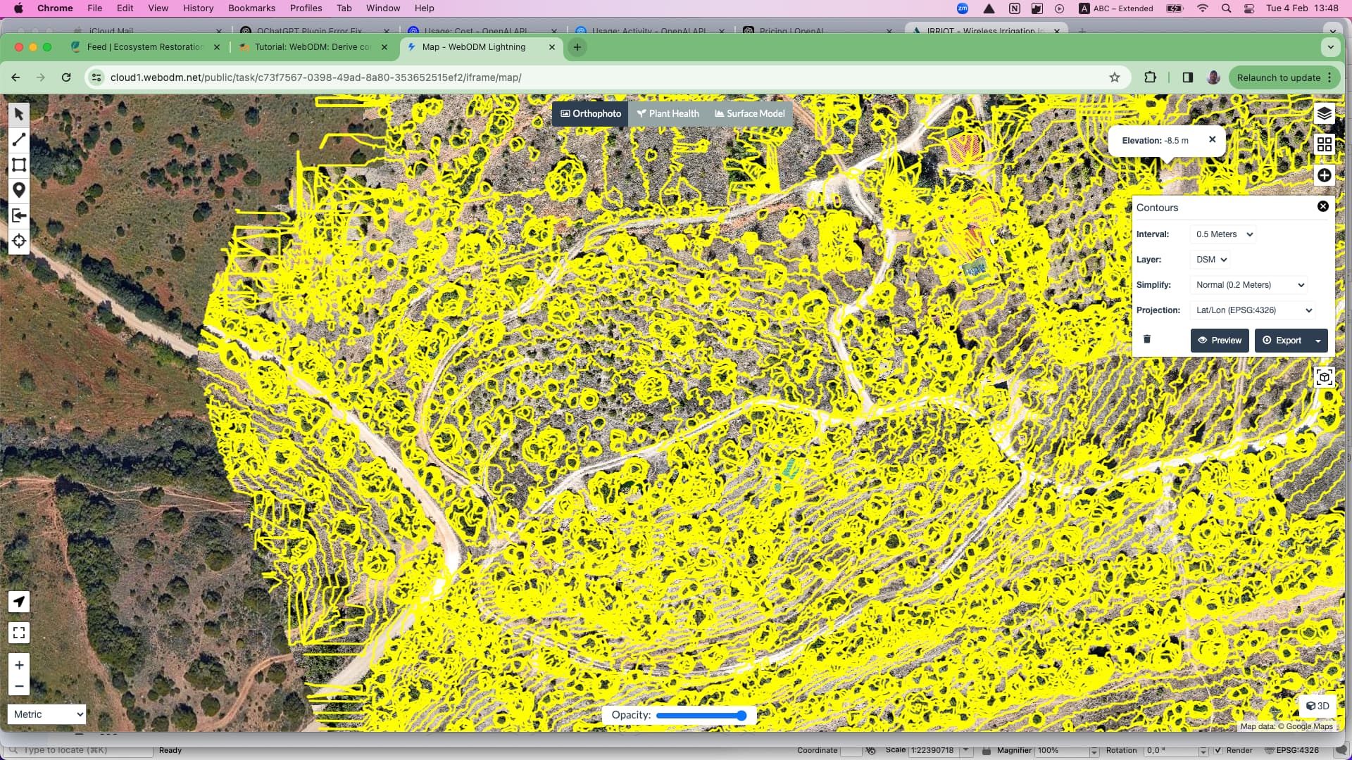
Awesome! i didn’t know about this feature, which works even on models hosted in the Lightning online service -see this screenshot of a preview i just generated of a ~10ha patch on our farm. Kinda funky, the way it makes contour lines not only along the ground, but also around tree canopies… But hey: it does give you a sense of the lay of the land. Check this out: